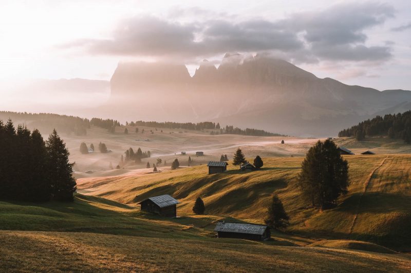
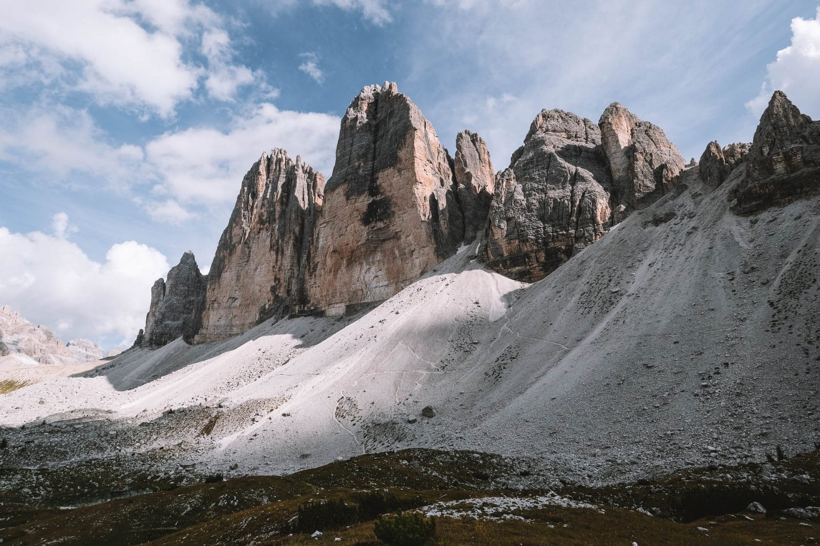
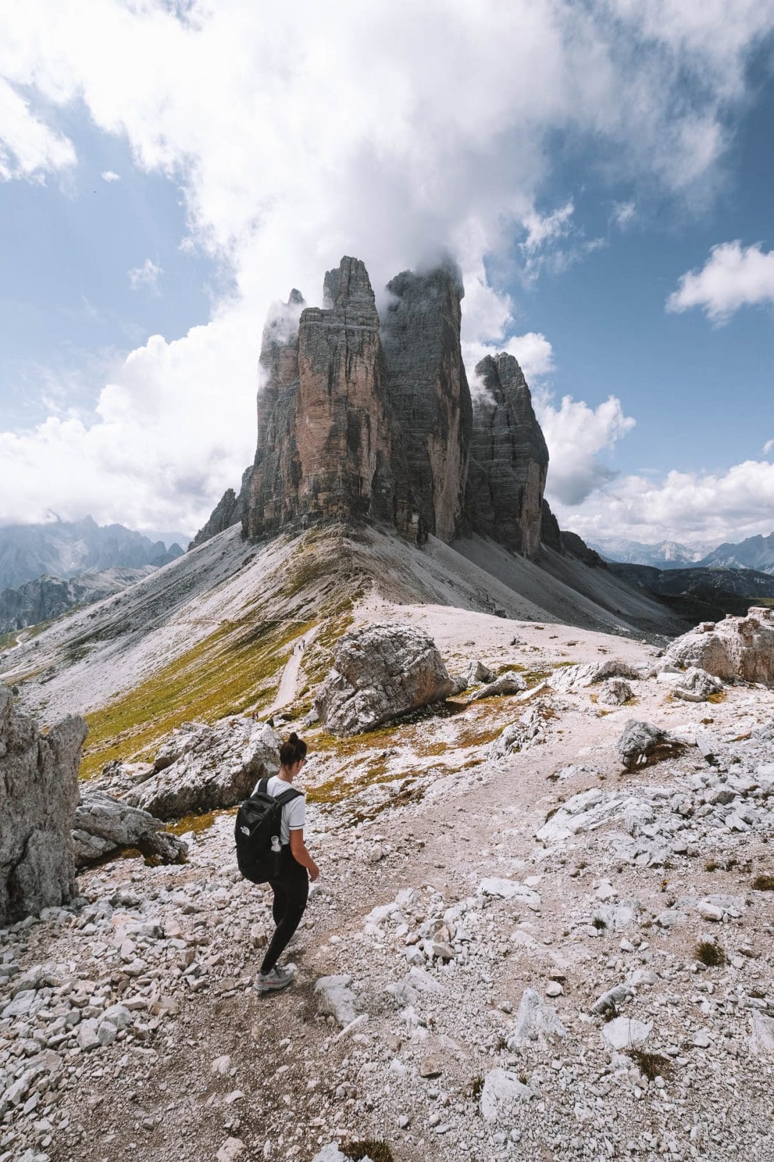
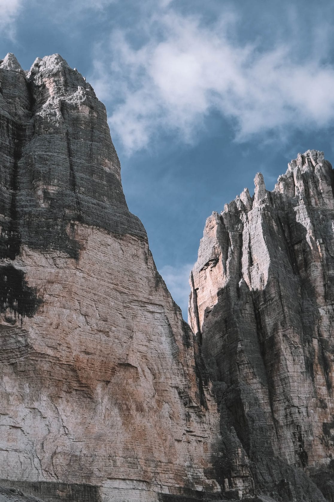
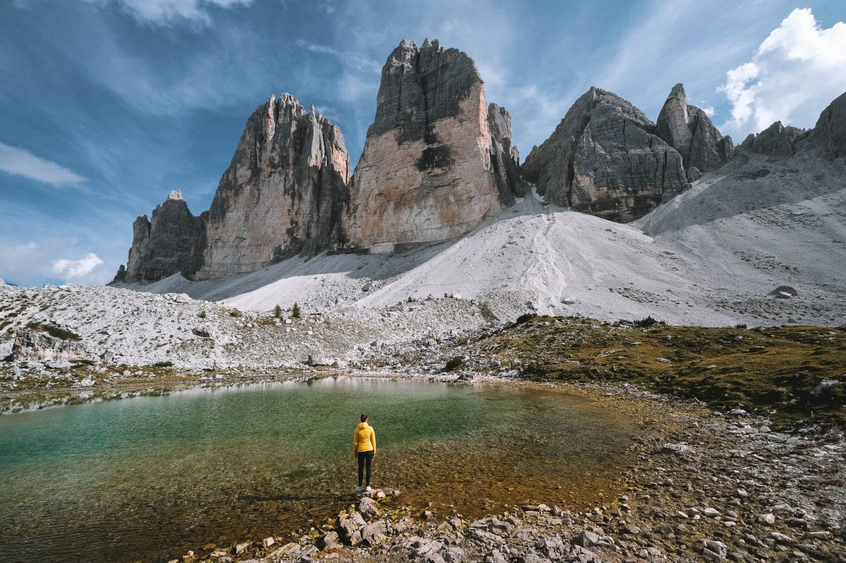
The mountains of Tre Cime are iconic for the Dolomites. Three enormous peaks suddenly rise to a height of nearly 600 meters out of nowhere. In photos, it’s already impressive, but this is one of those places that is 10 times more impressive in person. We took a beautiful hike around the Tre Cime, ticking off the most beautiful spots in this area. In this article, we will share our hiking route along with useful tips for the hike.


Is it Drei Zinnen or Tre Cime di Lavaredo?
Many places in the Dolomites have both Italian and German names. Drei Zinnen (Three Peaks) is the German name, while Tre Cime di Lavaredo is the Italian name for this mountain. This is because the Dolomites belonged to Austria until 1918. Nowadays, the entire Dolomites region is part of Italy, but the German names have remained. We’ll use the name Drei Zinnen for convenience in this article.

How to Get to Drei Zinnen?
There are several options to reach Drei Zinnen.
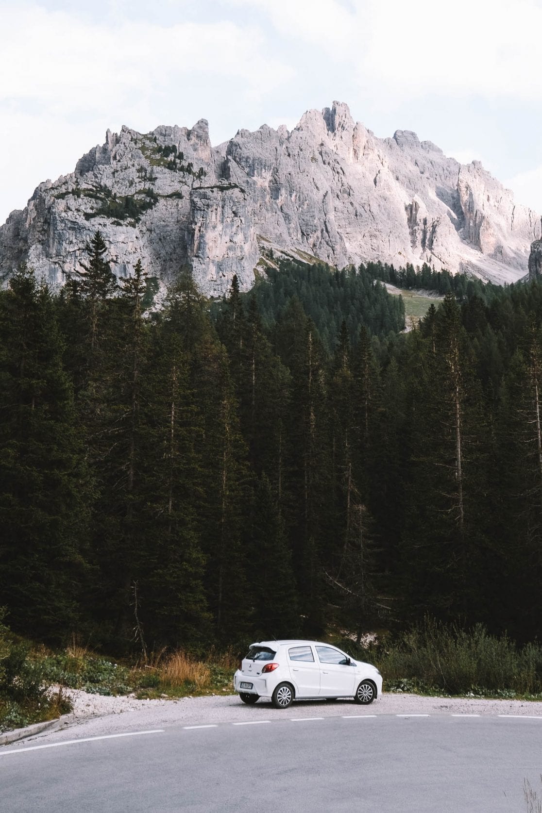
By Car (reserve parking in advance!)
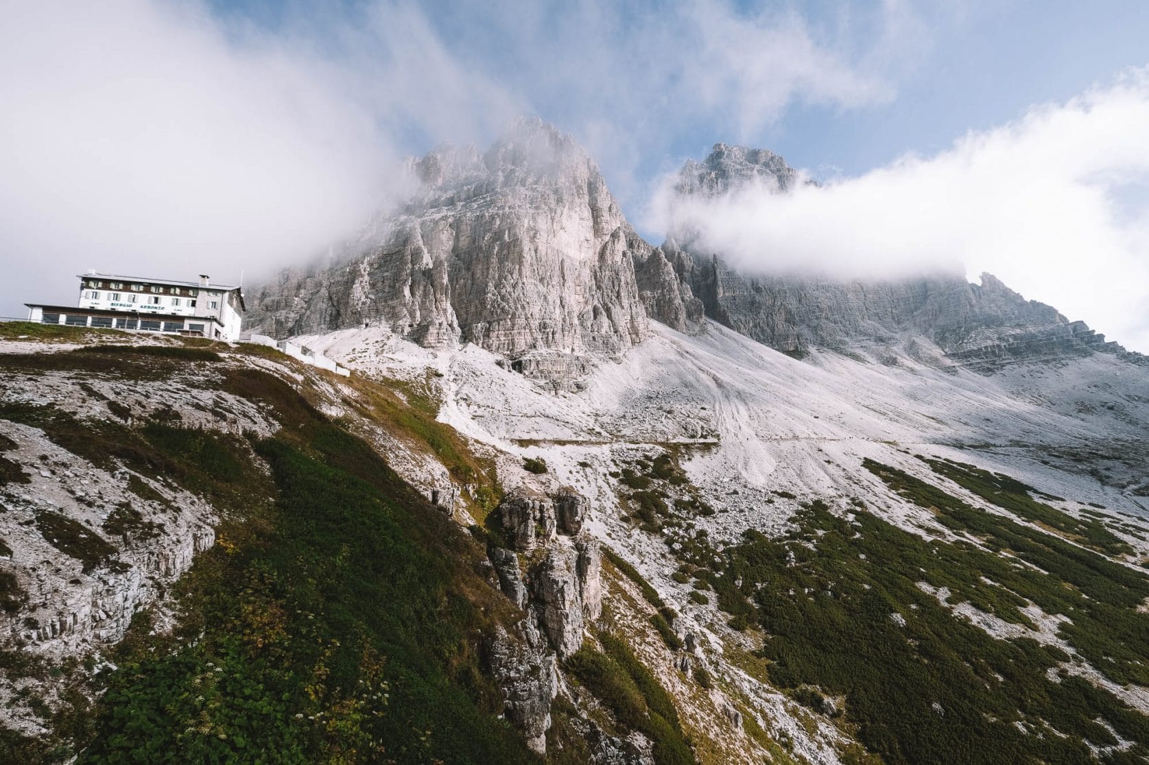
The easiest way to reach Drei Zinnen is by (rental) car. The parking lot is right next to Rifugio Auronzo, which is the starting point of the hike. Keep in mind that the parking ticket is quite expensive and must be reserved in advance. Be sure to book early, as tickets can sell out several days ahead of time.
Hiking
If you don’t want to pay $34 dollars for parking, you can choose to hike to Drei Zinnen. Park your car at Parcheggio Libero and hike for about 1.5 to 2 hours, which is approximately 3,280 to 4,370 feet (1,000 to 1,330 meters), to Rifugio Auronzo. Keep in mind that this is a fairly challenging hike with significant elevation gain. In our opinion, it’s a bit of a waste because you’ll expend a lot of energy before even reaching Drei Zinnen. We highly recommend paying the $30 and enjoying your visit to Drei Zinnen with full energy.
By Bus
During the summer months, buses depart from several locations to Drei Zinnen. Check the official website for more information and current bus schedules.


The Hike to the Most Beautiful Spots of Drei Zinnen
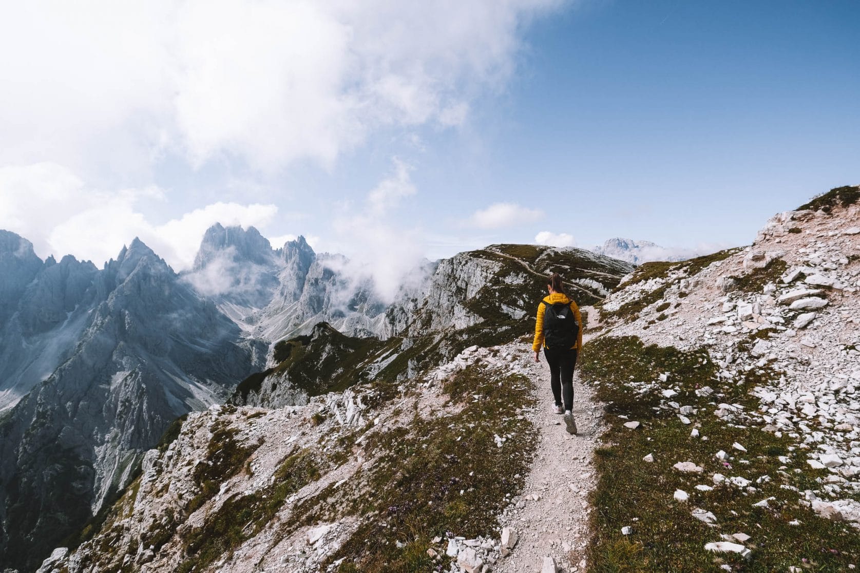
There is so much beauty to see around Drei Zinnen, but most people miss out because they don’t do their research. We have searched for the most beautiful spots and have outlined this hiking route for Drei Zinnen. The route is approximately 14 kilometers (8.7 miles) long, and it takes about 5 hours to hike. However, feel free to dedicate the whole day and explore one of the most beautiful places in the Dolomites at your own pace. Along the way, you’ll come across many mountain huts where you can enjoy some food and drinks. It’s also delightful to lie in the grass here and there and soak in the impressive views. The route is very accessible with minimal elevation gain, so 5 hours of hiking may sound more tiring than it actually is.
Let’s note: on our route, the last section to the Cadini Di Misurina viewpoint is missing. After completing the entire loop around Drei Zinnen, you will return to the parking lot at Rifugio Auronzo. From there, it takes about 30 minutes to walk to the Cadini Di Misurina viewpoint. Since the route is not yet available on Google Maps, we will describe exactly how to get there later on.


Overview of the Hike
Below you’ll find an overview of the hiking route broken down into sections. We’ve also described what you can see along the way for each section. If you find the hike too long, you can shorten it by skipping some sections.
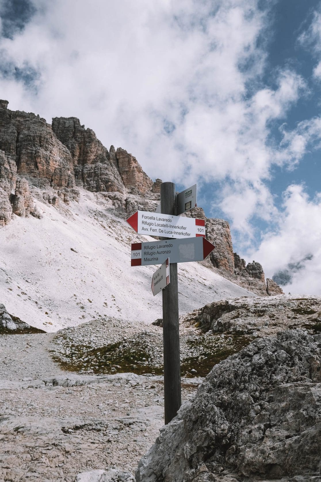
1. Rifugio Auronzo to Forcella Lavaredo / 2.4 km (1.5 miles) – 50 min
2. Forcella Lavaredo to Rifugio Locatelli / 1.7 km (1.1 miles) – 30 min
3. Rifugio Locatelli to Malga Langalm / 3.6 km (2.2 miles) – 1.5 hours
4. Malga Langalm to Rifugio Auronzo / 2.6 km (1.6 miles) – 45 min
5. Rifugio Auronzo to Cadini Di Misurina / 1.5 km (0.9 miles) – 30 min
6. Cadini Di Misurina to Rifugio Auronzo / 1.5 km (0.9 miles) – 30 min


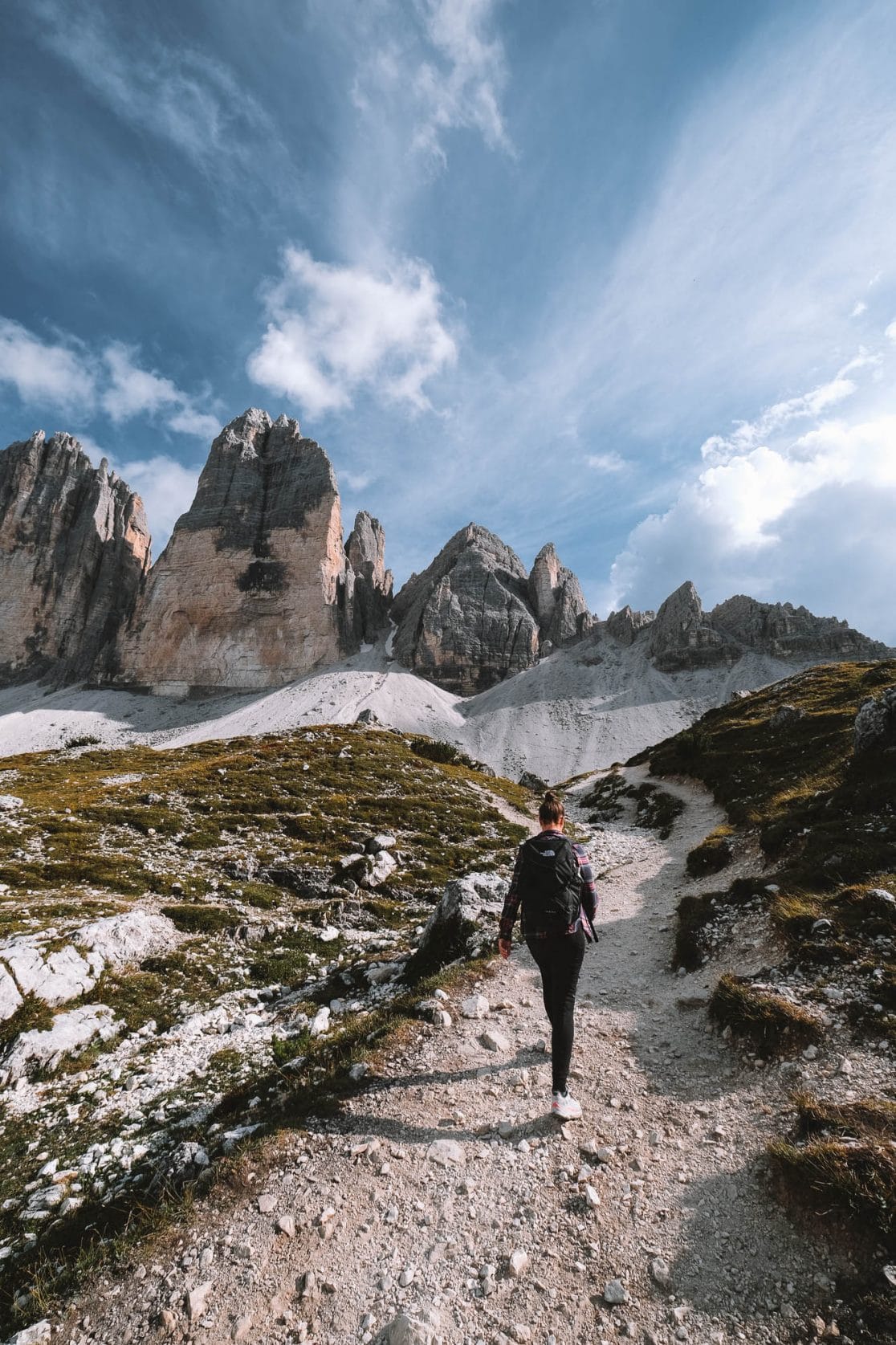
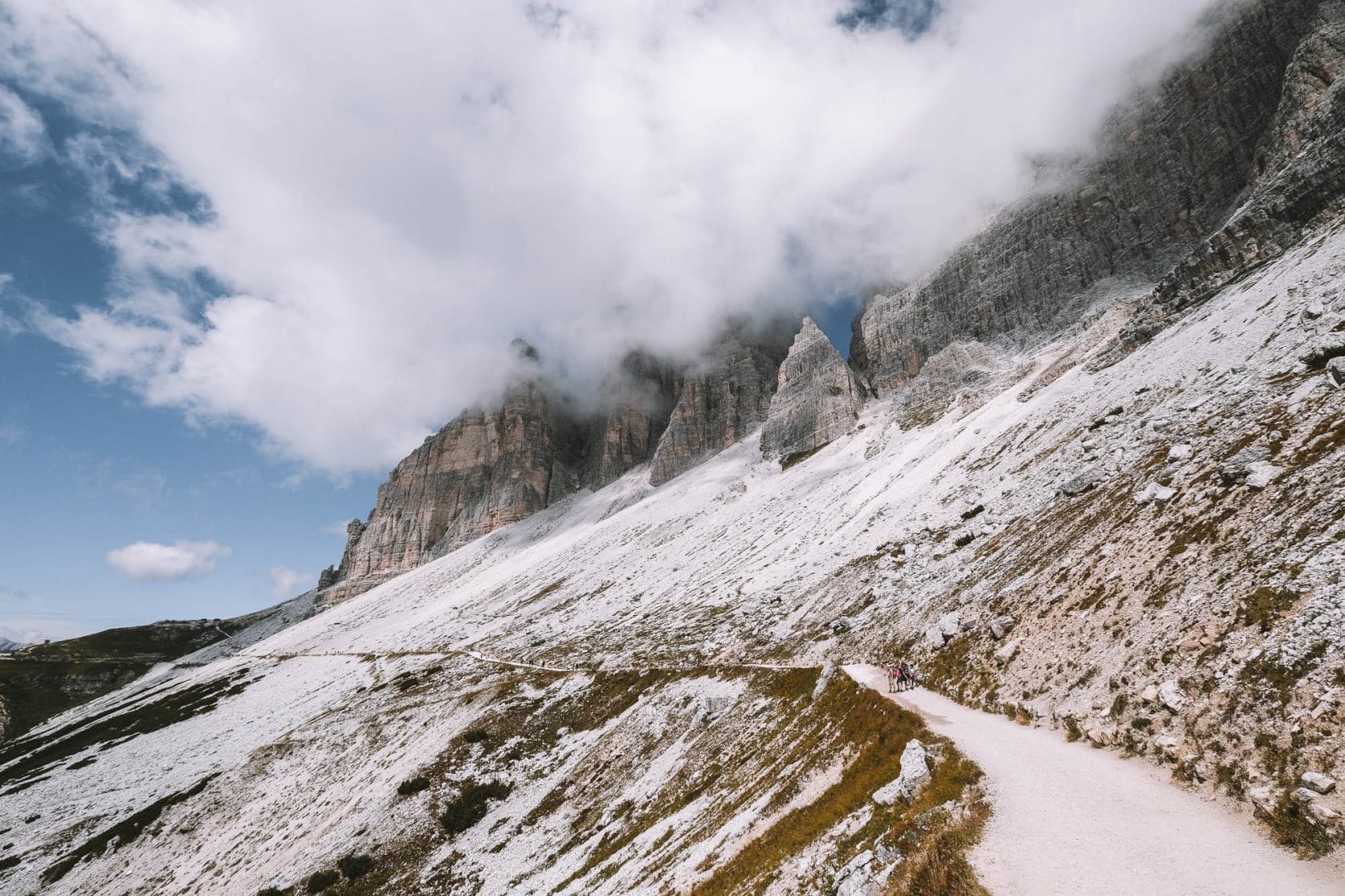
1. Rifugio Auronzo to Forcella Lavaredo
Distance: 2.4 km (1.5 miles) – 50 min
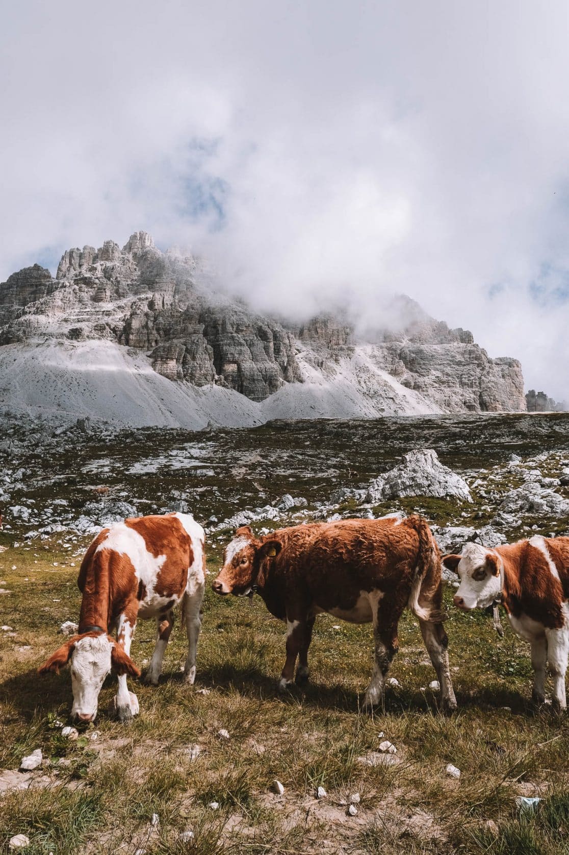
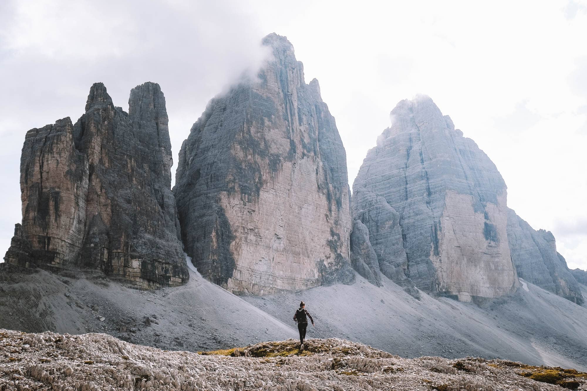
After parking your car, you’ll be face to face with the towering peaks of Drei Zinnen, and believe us, it’s breathtaking. You’ll walk eastward on a wide path and immediately be treated to fantastic views. After a short half-hour walk, you’ll reach the first mountain hut called Lavaredohutte. From Lavaredohutte, you’ll walk between grazing cows towards the Forcella Lavaredo viewpoint. This section involves some uphill walking, but it won’t be too exhausting. From Forcella Lavaredo, you’ll have one of the most amazing views of Drei Zinnen.
Tip: Take a short hike up the mountain from Forcella Lavaredo to get a distant view of Drei Zinnen and capture an amazing photo.


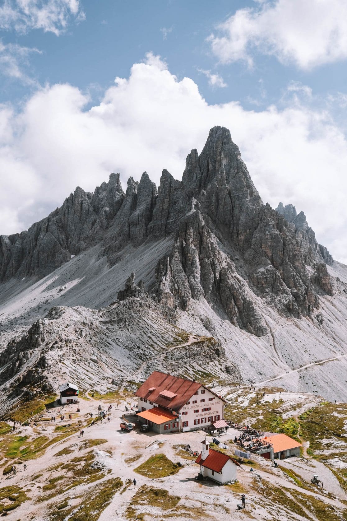
2. Forcella Lavaredo to Rifugio Locatelli
Distance: 1.7 km (1.1 miles) – 30 min
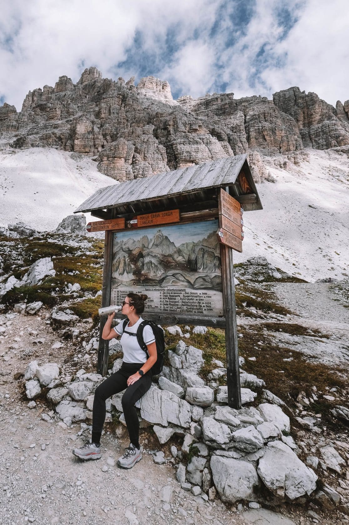
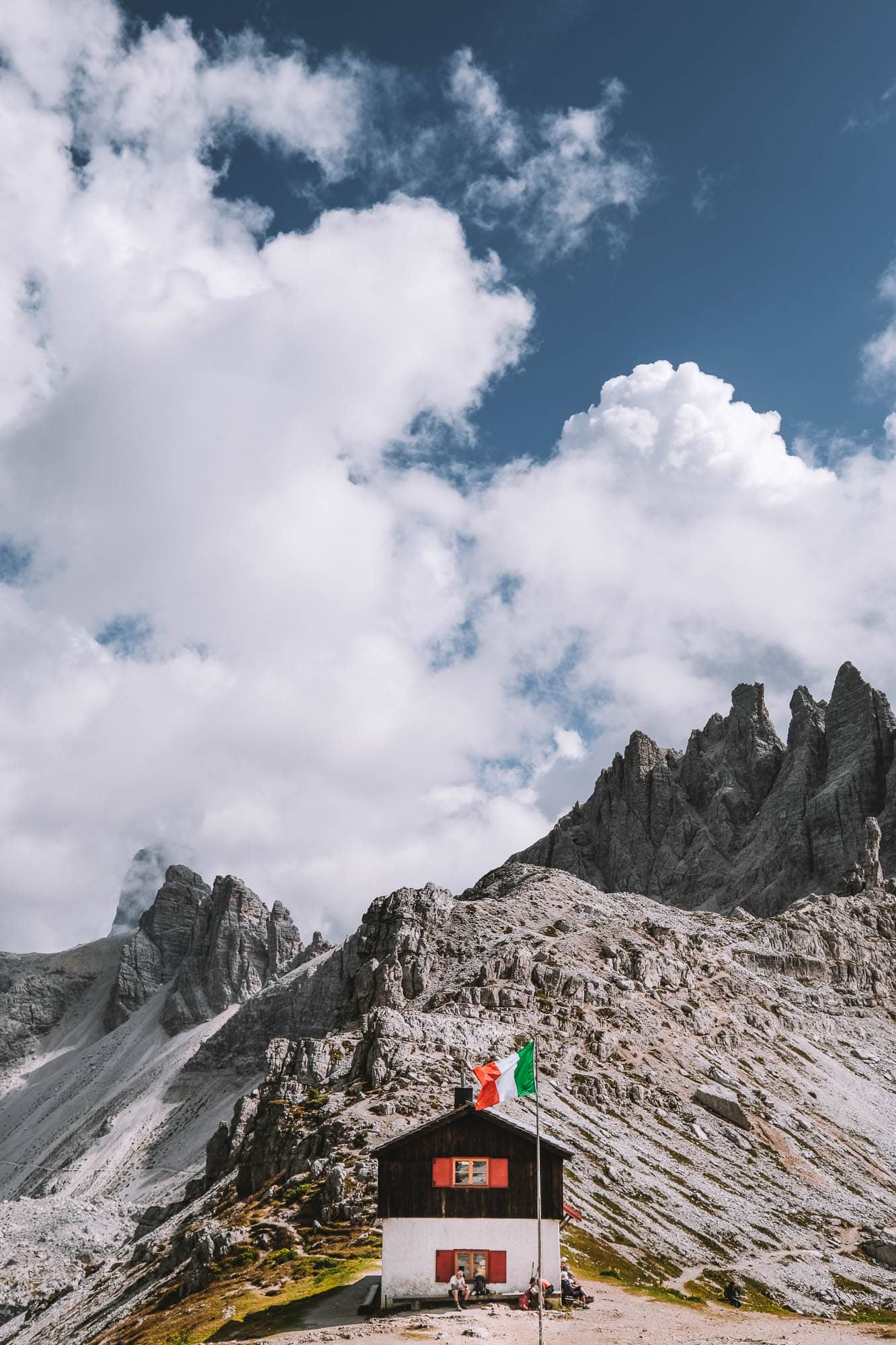
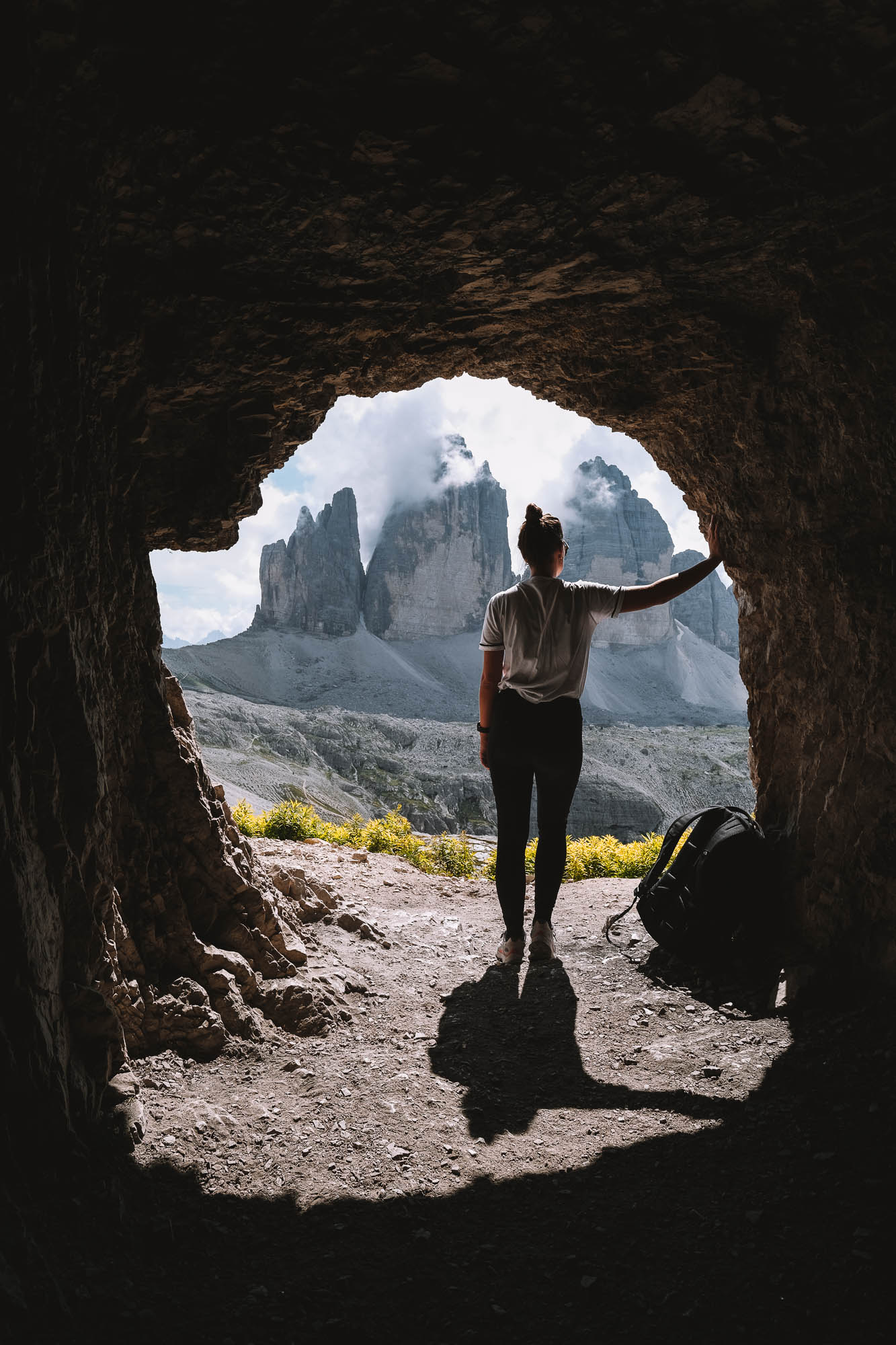
After enjoying the view, continue walking towards the next mountain hut. This hut is called Rifugio Locatelli, also known as Dreizinnenhütte, and is situated in a fantastic location amidst the rugged mountains. There are multiple paths to Rifugio Locatelli, but the wide path is the easiest as it is mostly flat. Only the last part involves a small climb. After about half an hour, you’ll arrive at Rifugio Locatelli, and on the mountain behind the hut, you’ll see three caves. From these caves, you’ll have a fantastic view of Drei Zinnen and can take some great photos. Afterwards, relax on the terrace or, during warm temperatures, on the grass and take a well-deserved break. You can enjoy a beer and a delicious plate of pasta with the best view of Drei Zinnen from here.


3. Rifugio Locatelli to Malga Langalm
Distance: 3.6 km (2.2 miles) – 1.5 hours
When walking to Malga Langalm, you have the option to take the route through the valley or a path closer to Drei Zinnen. If you choose the route through the valley, you’ll have to do more ascending and descending, and you’ll have less of a view of Drei Zinnen, so we opted for the other option. You’ll walk back a bit along the same route you came from, and then turn right. If in doubt, always check our route on Google Maps. Here, you leave the crowds behind because most people are not familiar with this route. The path goes through a beautiful area, and just before the mountain hut Malga Langalm, you’ll come across a few small lakes. It’s nice to take a short walk to these lakes, as you’ll likely have this place all to yourself!

4. Malga Langalm to Rifugio Auronzo
Distance: 2.6 km (1.6 miles) – 45 min
From Malga Langalm, you’ll walk back to Rifugio Auronzo where you started the day. The view of Drei Zinnen from here is less spectacular, but you’ll have a magnificent view of the surrounding area.

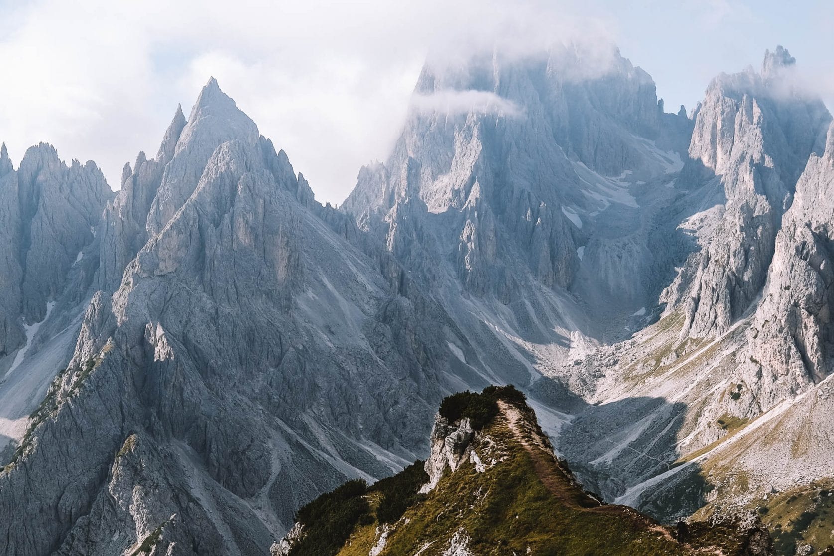
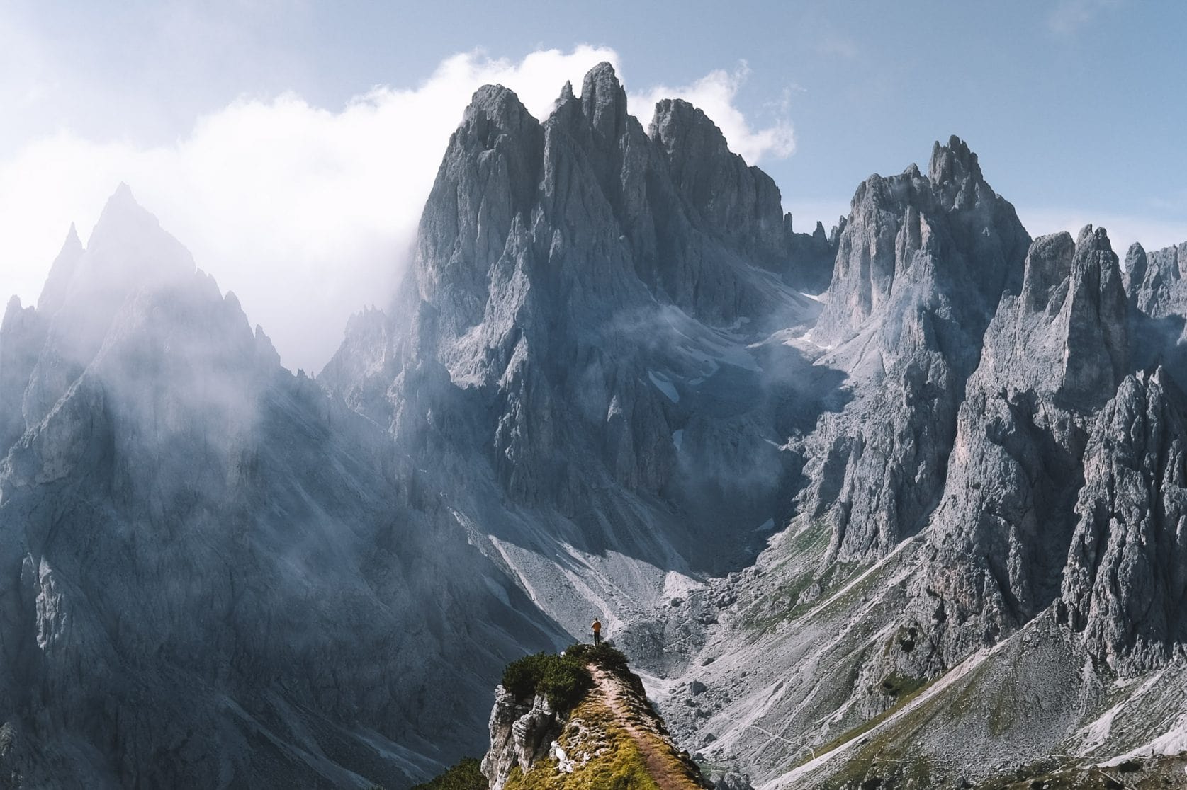
5. Rifugio Auronzo to Cadini Di Misurina
Distance: 1.5 km (0.9 miles) – 30 min
The day is not over yet because there’s still an impressive viewpoint planned. Unlike Drei Zinnen, Cadini Di Misurina is not crowded at all. We don’t understand why because it’s only a half-hour walk for a brilliant view. The hiking route from Rifugio Auronzo to Cadini Di Misurina is not shown in Google Maps. Download the app maps.me and the map of Northern Italy within it. Search for these coordinates: 46.601622, 12.295076. You can easily find it now, but don’t follow the entire path indicated in the app. The first part of the path in the app is correct. From Rifugio Auronzo, you’ll descend for quite a while until you eventually have to climb again. According to the app, you should follow the path to the left at this point, but you’ll quickly notice that it leads to a dangerous spot due to the narrow path and steep cliff. It’s better to go to the right and walk towards the coordinates.

6. Cadini Di Misurina to Rifugio Auronzo
Distance: 1.5 km (0.9 miles) – 30 min
Cadini Di Misurina was the last viewpoint for the day. Walk back the same way to Rifugio Auronzo and to your car at the parking lot.

The best time to visit Drei Zinnen
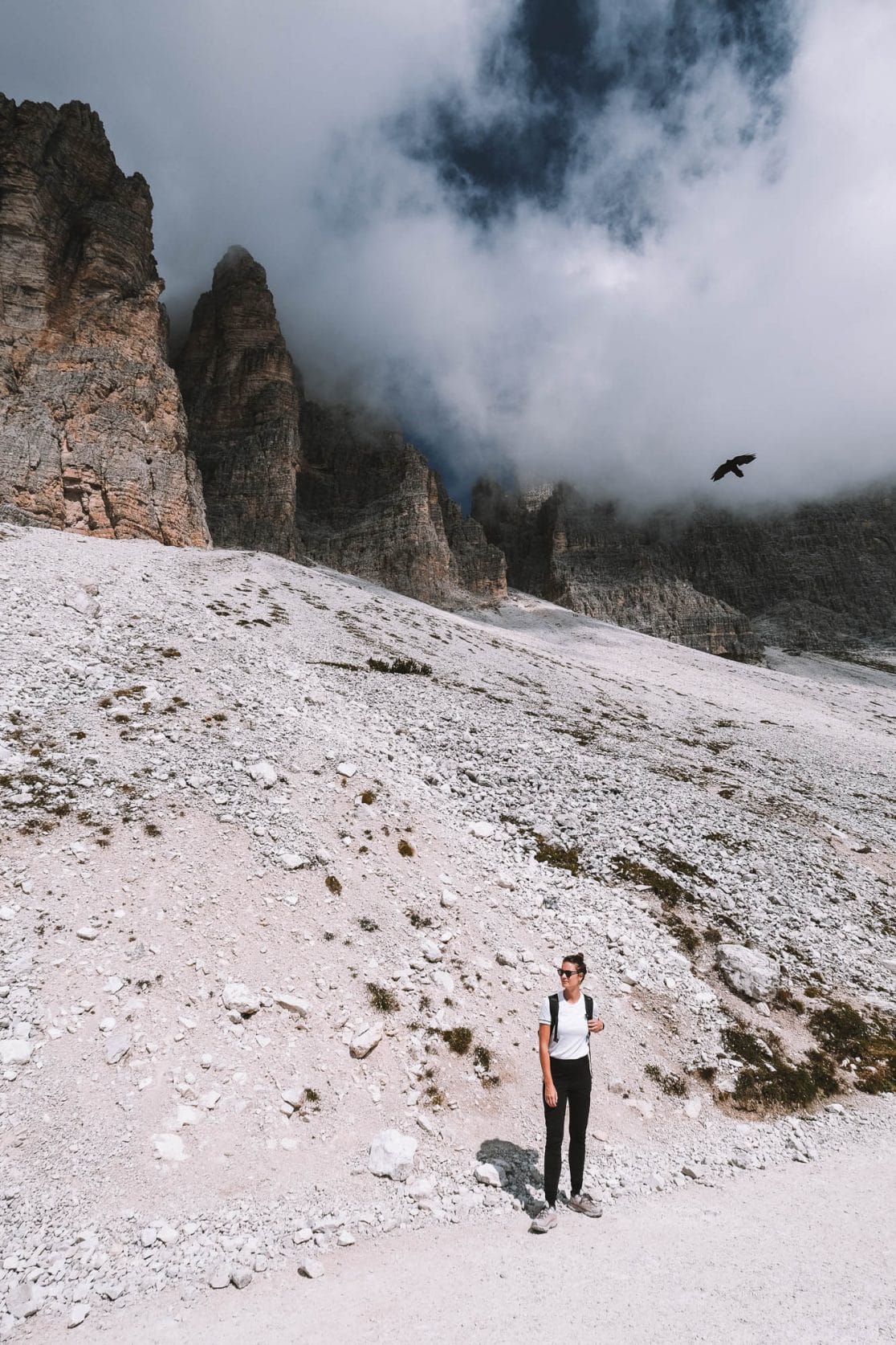
Drei Zinnen is one of the most popular attractions in the Dolomites, and during the peak season (July and August), it can be very crowded. In terms of weather, these are definitely good months to visit Drei Zinnen, but be prepared for crowds and try to go before 8:00 AM. In June and October, it’s much less crowded, but there’s a higher chance of less favorable weather. If it snows heavily early or late in the year, there’s even a chance that the road will be closed, and you won’t be able to drive into the area. If you choose to go before June or in October, we recommend going in late June or early October. September is the best month to visit Drei Zinnen. The crowds have decreased, and there’s a good chance of good weather.


Tips for the hike at Drei Zinnen
- Start your day as early as possible to avoid crowds
- Bring cash as the mountain huts only accept cash payment
- Bring a water bottle as you can refill it at the mountain huts
- Wear sturdy shoes
- Pack a rain jacket and a small bottle of sunscreen in your backpack to be prepared for any kind of weather